
High Falls is the largest waterfall in DuPont State Recreational Forest and our personal favorite of the forest’s many waterfalls. Here, the Little River slides approximately 120 feet down a massive granite rock face, creating an impressive waterfall that can be enjoyed from both a scenic overlook and a trail leading to the base.
We returned to High Falls in August 2026 while hiking from the Hooker Falls Access Area, continuing past Triple Falls and following the High Falls Trail upstream. We followed the River Bend Trail to the base before continuing uphill to the main overlook, where you can appreciate the full size of the waterfall.
In this guide, we’ll share current information from our visit, including where to park, what to expect along the hike, the best places to view High Falls, how to reach the covered bridge above the waterfall, and what you should know before visiting.
Updated: September 2026 - Completely revised with current information and new photos from our August visit.
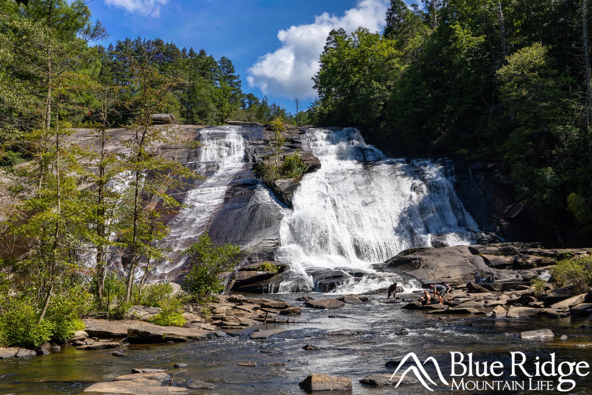
Need to Know |
|---|
Location: DuPont State Recreational Forest, near Brevard, NC |
Accessible: Not by the standard hiking trail. Visitors with limited mobility may apply in advance for a permit providing vehicle access to the High Falls shelter and covered bridge on select days. |
Dog Friendly: Yes, but dogs must remain on a leash. |
Distance: Approximately 1 mile round trip from the High Falls Access Area or 2 miles round trip from the Hooker Falls Access Area. Visiting the base or covered bridge adds additional distance. |
Difficulty: Moderate. |
Features: 120-foot waterfall, scenic overlook, trail to the base, covered bridge, picnic shelter, visitor center, restrooms, and a large parking area. |
Directions: From Asheville, take I-26 East to Exit 40 for Asheville Regional Airport. Turn right onto NC 280 and continue approximately 16 miles toward Brevard. Turn left onto US 64 East and travel 3.7 miles. Turn right onto Crab Creek Road and continue for 4.3 miles. Turn right onto DuPont Road, which becomes Staton Road, and continue approximately 4 miles. Pass the Hooker Falls Access Area and look for the High Falls Access Area on the left. For GPS navigation, use 89 Buck Forest Road, Cedar Mountain, NC 28718. |
Is High Falls Open After Hurricane Helene?
Yes, High Falls is open following Hurricane Helene. We visited in August 2026 and were able to reach the main overlook, follow the River Bend Trail to the base of the waterfall, and hike the High Falls Loop. The covered bridge and trails leading to it were also open, although we did not make the additional hike to the bridge during this visit.
Parking at High Falls
During our August 2026 visit, we were hiking the three-waterfall route to Hooker Falls, Triple Falls, and High Falls, so we parked at the Hooker Falls Access Area. This is the best starting point if you want to visit all three waterfalls during the same hike.
The Hooker Falls Access Area has two parking lots. The upper lot beside the restrooms is closer to the pedestrian bridge and the beginning of the trail to Triple Falls and High Falls. If that lot is full, additional parking is available farther down the hill. From here, the hike to the High Falls overlook is approximately one mile each way and passes Triple Falls along the way.
If you are visiting only High Falls, the High Falls Access Area is the closest and most convenient place to park. Located at 89 Buck Forest Road in Cedar Mountain, this large parking area is home to the Aleen Steinberg Visitor Center, public restrooms, picnic tables, and trail maps. High Falls is approximately 0.5 mile from the visitor center.
Parking is free and available on a first-come, first-served basis. Both access areas can fill early during summer, fall color season, weekends, and holidays. Plan to arrive before 9 a.m. or later in the afternoon, and never park along Staton Road.
Hiking to High Falls
High Falls can be reached from either the Hooker Falls Access Area or the High Falls Access Area. The High Falls Access Area provides the shortest route, but the Hooker Falls Access Area is the better starting point if you want to visit Hooker Falls, Triple Falls, and High Falls during the same hike.
From the Hooker Falls Access Area
During our August 2026 visit, we parked at the Hooker Falls Access Area and completed the three-waterfall hike. From the upper parking area, follow the signs for Triple Falls and High Falls and cross the pedestrian bridge over the Little River. The trail passes beneath Staton Road before continuing upstream beside the river.
After visiting Triple Falls, continue uphill on the High Falls Trail. This portion of the hike is approximately 0.5 mile and includes another gradual climb. As you approach High Falls, look for the River Bend Trail on the left. This side trail leads to the base of the waterfall and provides an impressive close-up view.
After visiting the base, return to the High Falls Trail and continue uphill to the main overlook and picnic shelter. You can then continue toward the Covered Bridge Trail to reach the covered bridge above High Falls.
The hike from the Hooker Falls Access Area to the High Falls overlook is approximately one mile each way. The complete three-waterfall hike is approximately three miles round trip, although your total distance will vary depending on which overlooks and side trails you visit.
From the High Falls Access Area
For the shortest route, begin at the High Falls Access Area beside the Aleen Steinberg Visitor Center. Follow the signs for the High Falls Loop and High Falls Trail. The waterfall overlook is approximately 0.5 mile from the parking area.
The trail is wide and mostly gravel, but it includes several hills. Much of the walk toward the waterfall is downhill, which means you should expect an uphill return to the parking area.
From the main trail, you can visit the High Falls overlook, take the River Bend Trail to the base, or continue toward the covered bridge. Trail intersections are well marked, but DuPont has an extensive network of connecting trails, so we recommend carrying a map or taking a photo of the trail map at the parking area.
High Falls
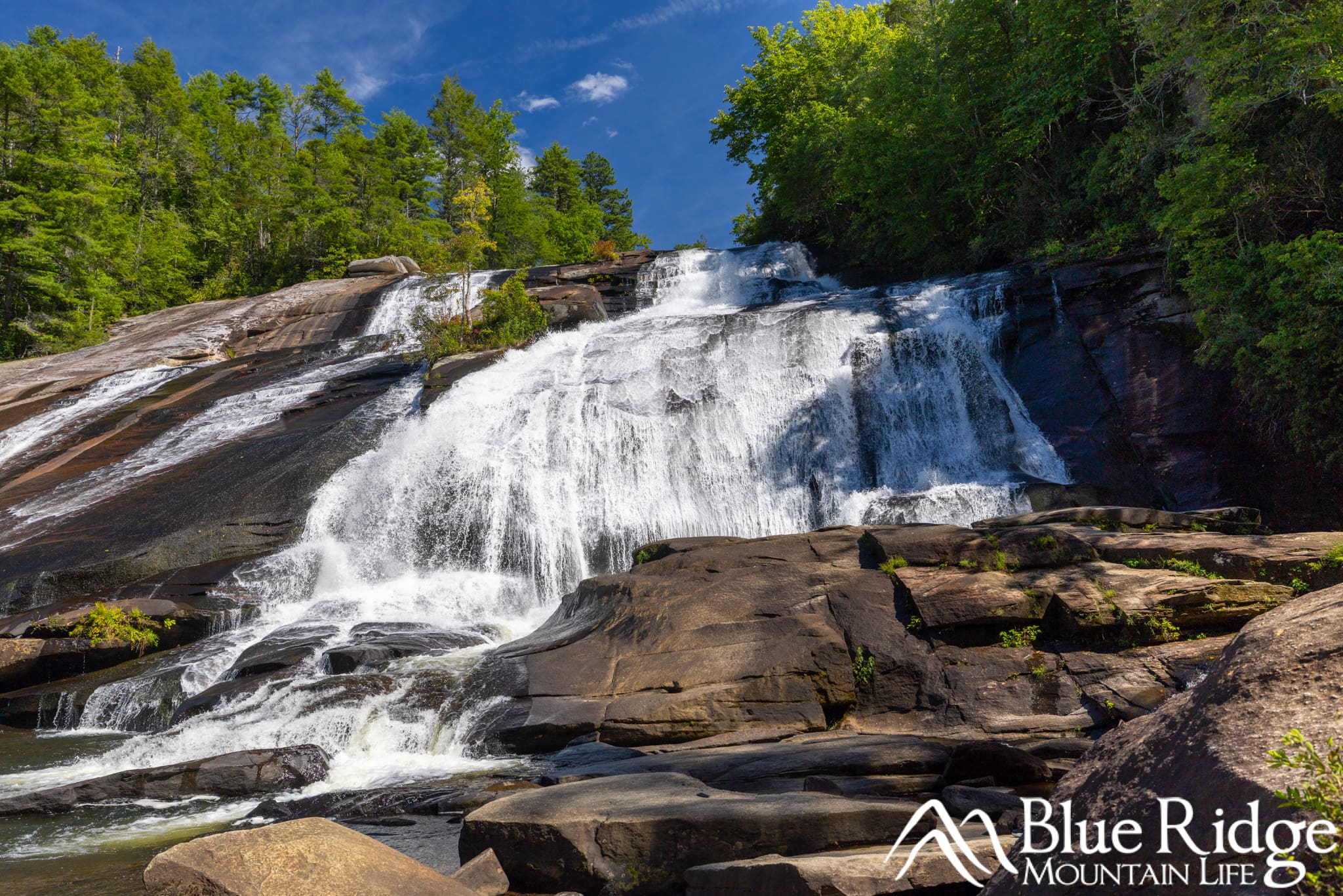
High Falls is the largest waterfall in DuPont State Recreational Forest. The Little River slides approximately 120 feet down a massive granite rock face before flowing into the rocky pools below. Its size, beautiful setting, and variety of viewpoints make it our favorite waterfall at DuPont.
The appearance of High Falls can change significantly depending on recent rainfall. During wetter periods, the river spreads across much of the granite face, creating a wide and powerful cascade. During drier periods, more of the exposed rock becomes visible and the waterfall is divided into narrower sections.
High Falls Overlook

The main overlook is located just off the High Falls Trail beside a picnic shelter. This is the best place to appreciate the full height and width of the waterfall. From here, you can see the Little River cascading down the granite face with the covered bridge visible above the waterfall.
The overlook is a great place to stop for a break, enjoy a picnic, or photograph the entire waterfall. It also provides an excellent view for visitors who do not want to hike the rockier River Bend Trail to the base.
The Base of High Falls
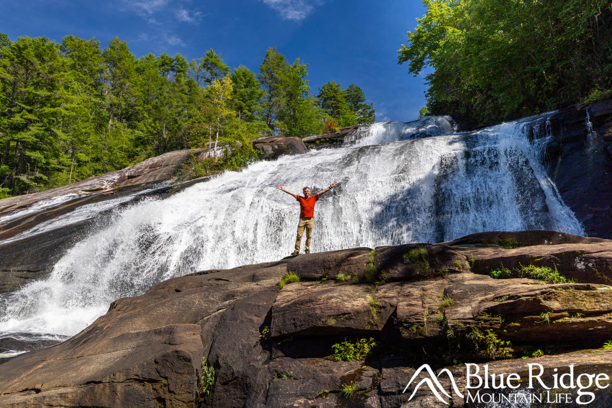
For a much closer view, follow the River Bend Trail to the bottom of High Falls. We hiked this trail during our August 2026 visit and were able to reach the base without encountering any closures.
The trail follows the Little River before reaching a rocky area directly below the waterfall. From here, you can fully appreciate the size, sound, and power of High Falls. The roar of the water and cool spray create a completely different experience from the more distant overlook.
There is a large rock at the base of the fall (you can see Larry on it in the photo above) that makes for great photo opportunities, just be careful climbing up.
High Falls Covered Bridge
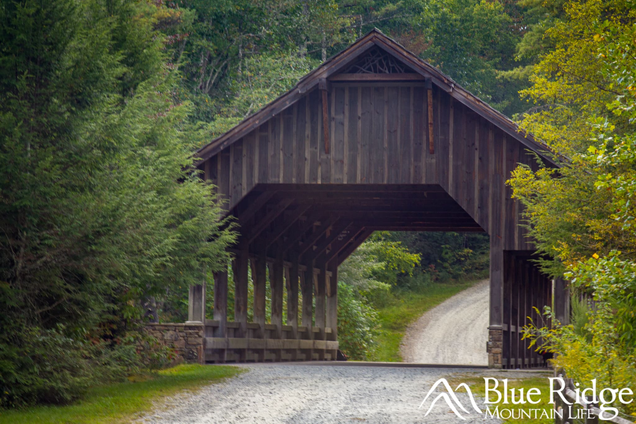
The covered bridge above High Falls is one of the most recognizable features in DuPont State Recreational Forest. It crosses the Little River just before the water reaches the top of the waterfall, where the calm river quickly transitions into the powerful cascade below.
We did not hike to the covered bridge during our August 2026 visit, but we could see it above the waterfall from the High Falls overlook. We have visited and walked across the bridge during previous trips to DuPont.
Although the bridge looks historic, it is relatively modern. It was built in 1999 by a company owned by developer Jim Anthony. Before the bridge was constructed, vehicles crossed the Little River using a rocky ford just above High Falls. The bridge eliminated the need for that potentially dangerous river crossing. The surrounding land was acquired by the North Carolina Forest Service in 2000.
The bridge can be reached directly from the High Falls Access Area by following Buck Forest Road for approximately 0.5 mile. From the High Falls overlook, continue uphill on the High Falls Trail and follow the signs for the Covered Bridge Trail.
Visitors with limited mobility may be able to obtain a free permit allowing them to drive from the High Falls Access Area to the covered bridge and High Falls picnic shelter on select days. Permits must be requested in advance through the DuPont State Recreational Forest limited-mobility permit program
Can You Swim at High Falls?
During our August 2026 visit, we saw several adults and teenagers swimming in the pools and smaller falls downstream from High Falls. Some were even sliding down the rocks into the pools below. However, the current appeared strong, and most of the people in the water appeared to be experienced, confident swimmers.
Based on what we observed, we would not consider High Falls a particularly good or safe place to swim. The area is rocky, the surfaces can be extremely slippery, and the strength of the current can change quickly depending on recent rainfall and water levels. Rocks and pools below the waterfall may also contain unstable rocks, submerged debris, and other hidden hazards.
For a more established waterfall swimming area, nearby Hooker Falls has a broad pool below the waterfall and is generally the better option when water levels and conditions are safe.
Visiting High Falls, Triple Falls, and Hooker Falls Together
High Falls can easily be combined with Triple Falls and Hooker Falls during one hike. The complete three-waterfall route is approximately three miles round trip, although the total distance will vary depending on which overlooks and side trails you visit.
This is the route we followed during our August 2026 visit. We parked at the Hooker Falls Access Area and began with the short hike to Hooker Falls. After returning to the parking area, we crossed the pedestrian bridge over the Little River and followed the Triple Falls Trail upstream.
After visiting the base and main overlook at Triple Falls, we continued along the High Falls Trail. High Falls was our final waterfall of the hike. We followed the River Bend Trail to the base and then continued to the main overlook before beginning our return hike.
The route is considered moderate, but the steep climb approaching Triple Falls and the continued uphill sections toward High Falls can be tiring. Allow at least two to three hours so you have time to enjoy each waterfall, take photos, and rest along the way. Bring water, wear sturdy shoes, and use extra caution near the rocky areas around the waterfalls.
For detailed directions covering the entire route, see our complete DuPont State Forest Waterfalls Trail Guide.
Where to Stay When Visiting High Falls

Downtown Hendersonville
Both Brevard and Hendersonville make convenient home bases for visiting High Falls and the other waterfalls in DuPont State Recreational Forest. The best choice depends on what else you would like to experience during your trip.
Staying in Brevard
Brevard is a great choice if waterfalls, hiking, and outdoor adventures are the primary focus of your visit. In addition to DuPont State Recreational Forest, you will be within easy driving distance of Pisgah National Forest, Looking Glass Falls, Sliding Rock, and many other popular outdoor destinations.
Downtown Brevard also offers a nice selection of restaurants, breweries, shops, and local businesses to enjoy after a day on the trails.
Staying in Hendersonville

Hendersonville is another excellent place to stay when visiting High Falls. Its lively downtown provides plenty of restaurants, shops, breweries, and evening activities, while still keeping you within a convenient drive of DuPont State Recreational Forest.
One of our top places to stay in Hendersonville is Echo Mountain Inn. We enjoyed its peaceful mountain setting, historic character, comfortable rooms, and freshly prepared breakfast. The inn dates back to 1896 and is located in Laurel Park, approximately three miles from downtown Hendersonville. It is a wonderful choice if you want a quiet and relaxing place to return to after hiking.
We also recommend Allora, a small boutique inn located just two blocks from Main Street in downtown Hendersonville. Allora offers a modern take on a traditional bed-and-breakfast, with comfortable rooms, welcoming common areas, gourmet breakfast, and freshly prepared coffee and espresso drinks. Its location makes it especially convenient for walking downtown for dinner, shopping, or an evening out.
Choose Echo Mountain Inn if you prefer a quiet mountain retreat, or Allora if being within walking distance of downtown is more important. You can find additional options in our Hendersonville, NC Travel Guide.
