
Crabtree Falls is one of our favorite waterfalls on the Blue Ridge Parkway. Located at Milepost 339.5 in North Carolina, this beautiful cascade is reached by a forest hike with rocky steps, creek crossings, and an uphill climb on the way back.
We have visited many times over the years, including hikes with our kids and trips to take photos. Returning after Hurricane Helene was something we had looked forward to for a long time, and we were so glad to finally be back.
Last hiked: November 11, 2026. Guide updated: November 13, 2026.
Is Crabtree Falls Open?
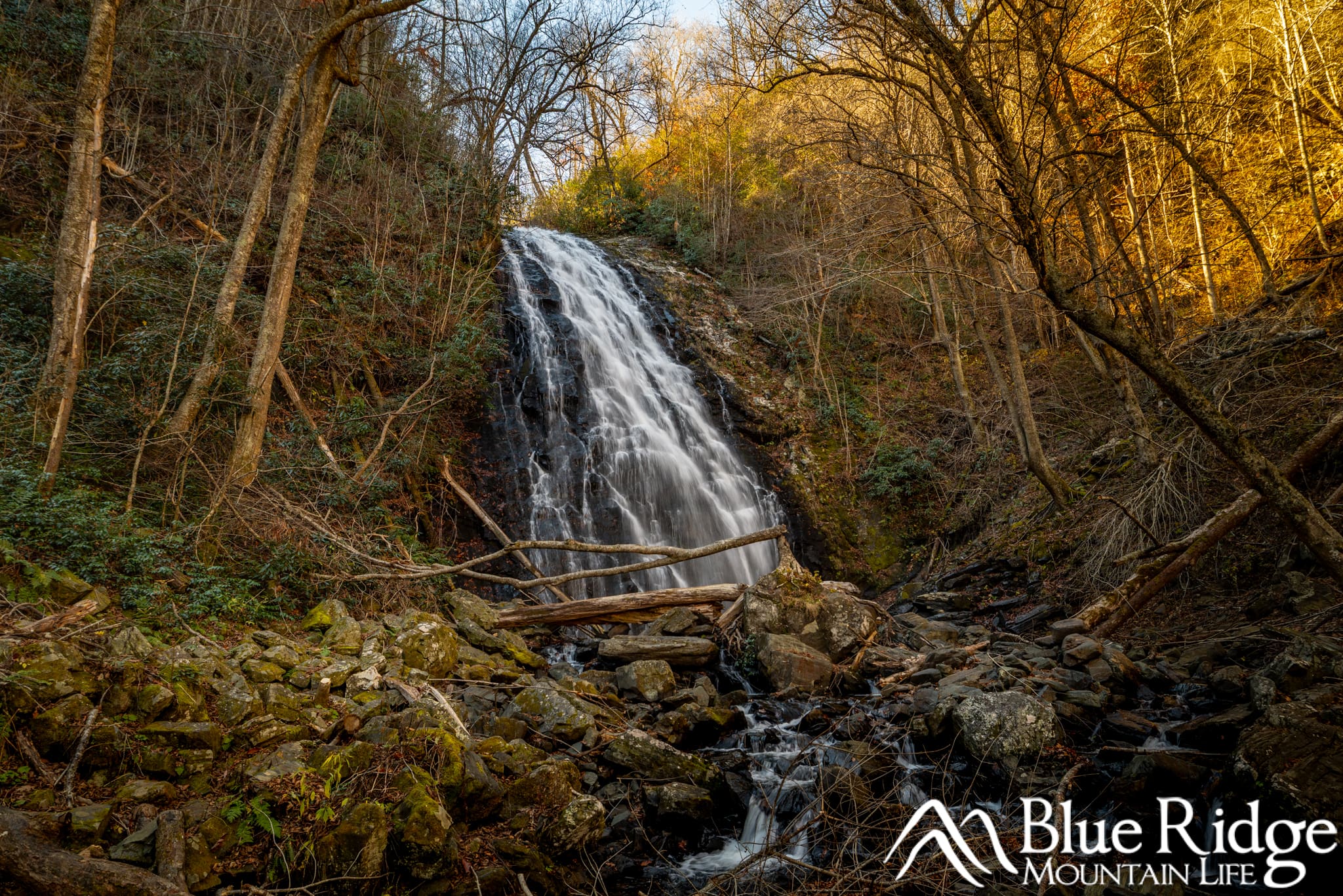
Crabtree Falls November 2026
Yes! Parkway access, parking, and the trail to Crabtree Falls have reopened. As of November 13, 2026, the hike is out and back only. According to the National Park Service, the longer loop remains closed because bridges are still out. The campground also remains closed to camping.
We hiked the reopened trail on November 11. Before your visit, check the National Park Service road status page for changes and closures elsewhere along your drive.
Be aware that if you are coming from the Asheville area, that the Blue Ridge Parkway is closed just a few miles west of Crabtree Falls. Since we're west of Asheville, we had to take I-40 to Marion, catch the parkway to the east of Crabtree Falls and arrive that way.
Need to Know |
|---|
Location: Blue Ridge Parkway Milepost 339.5, North Carolina |
Accessible: Not accessible. The trail has rocks, stairs, and steep sections. |
Dog Friendly: Yes, on a leash |
Distance: 3 Miles Roundtrip from the parking area, 1.5 miles out, and 1.5 miles back. |
Difficulty: Moderate to Strenuous |
Features: Waterfall, benches, Portable Restrooms in parking area |
Route: Out and back only. The longer loop remains closed because bridges are out. |
Getting to Crabtree Falls: Directions and Parking
Crabtree Falls is at Milepost 339.5 on the Blue Ridge Parkway, near Little Switzerland NC. This is the North Carolina waterfall, not Crabtree Falls in Virginia.
Follow signs for trail parking near the old Crabtree Falls camp store. From the parking area, the access path leads through the woods past the old amphitheater and into the campground area. Follow the waterfall trail signs toward Loop A and the trail map near the former campground parking lot.
The campground is currently closed to camping, but the signed hiking access is open. Portable restrooms are available at the Crabtree Falls Parking area.
The trail is a 3-mile roundtrip hike from the parking area, next to the parkway. 1.5 miles out and 1.5 miles back. Follow current signs if the route differs.
Hiking to Crabtree Falls: What to Expect

The Hike Down to the Falls
At the trail map, follow the trail toward Crabtree Falls, the trail is clearly marked and easy to follow. Taking a photo of the map is helpful, but remember that older maps may show the full loop, which is currently closed.
The trail descends through hardwood forest and thickets of rosebay rhododendron. It starts fairly wide and easy, then becomes narrower, steeper, and rockier. The rhododendron is especially pretty when blooming in summer.

At the loop junction, follow the open trail down toward the falls. There are rocky steps and switchbacks along the descent, so take your time and watch your footing.
On our November 11 hike, we saw fallen trees and significant trail repairs, including new bridges. Seeing the work firsthand gives you a real appreciation for what it took to reopen this trail.
As you get closer, you will hear the waterfall through the trees. The trail eases as you approach the creek below the falls.
The Uphill Hike Back
After enjoying the waterfall, return along the same trail. According to the Blue Ridge Parkway, the longer loop remains closed because bridges are still out.
The downhill walk becomes an uphill climb on the return trip. This is where the hike can feel strenuous, especially if you are not used to climbing stairs or hiking on uneven ground. Bring water, allow time for breaks, and save some energy for the walk out. Those benches definitely come in handy.
The Waterfall and What Changed After Helene
Crabtree Falls spreads across a tall, wide rock face, with a bridge crossing the creek below it. It is one of our favorite waterfalls to photograph, and on November 11 the waterfall itself looked fantastic and unchanged.
The photo below is from our November 11, 2026 visit after the trail reopened. The waterfall looked just as beautiful as we remembered, even though the bridge and surrounding creek area had changed.
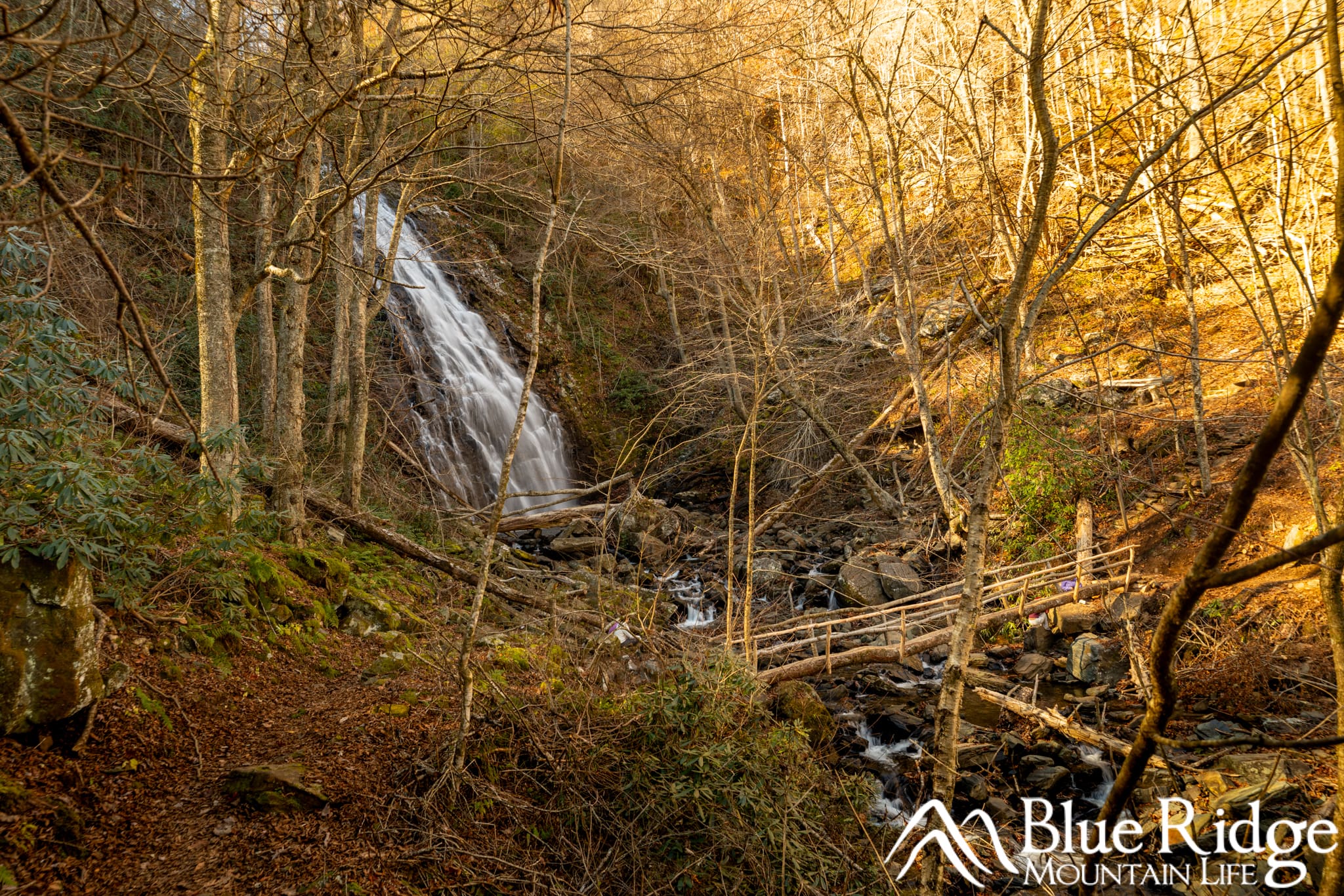
Crabtree Falls after Hurricane Helene
We have stood at this waterfall many times over the years, but that first visit back after the closure was special. Seeing the familiar waterfall again was something we had really missed.
The area below the waterfall had visible storm damage, including washed-out areas, rocks, fallen trees, and debris. The old bridge washed away during Helene, and a new bridge has been built in its place.
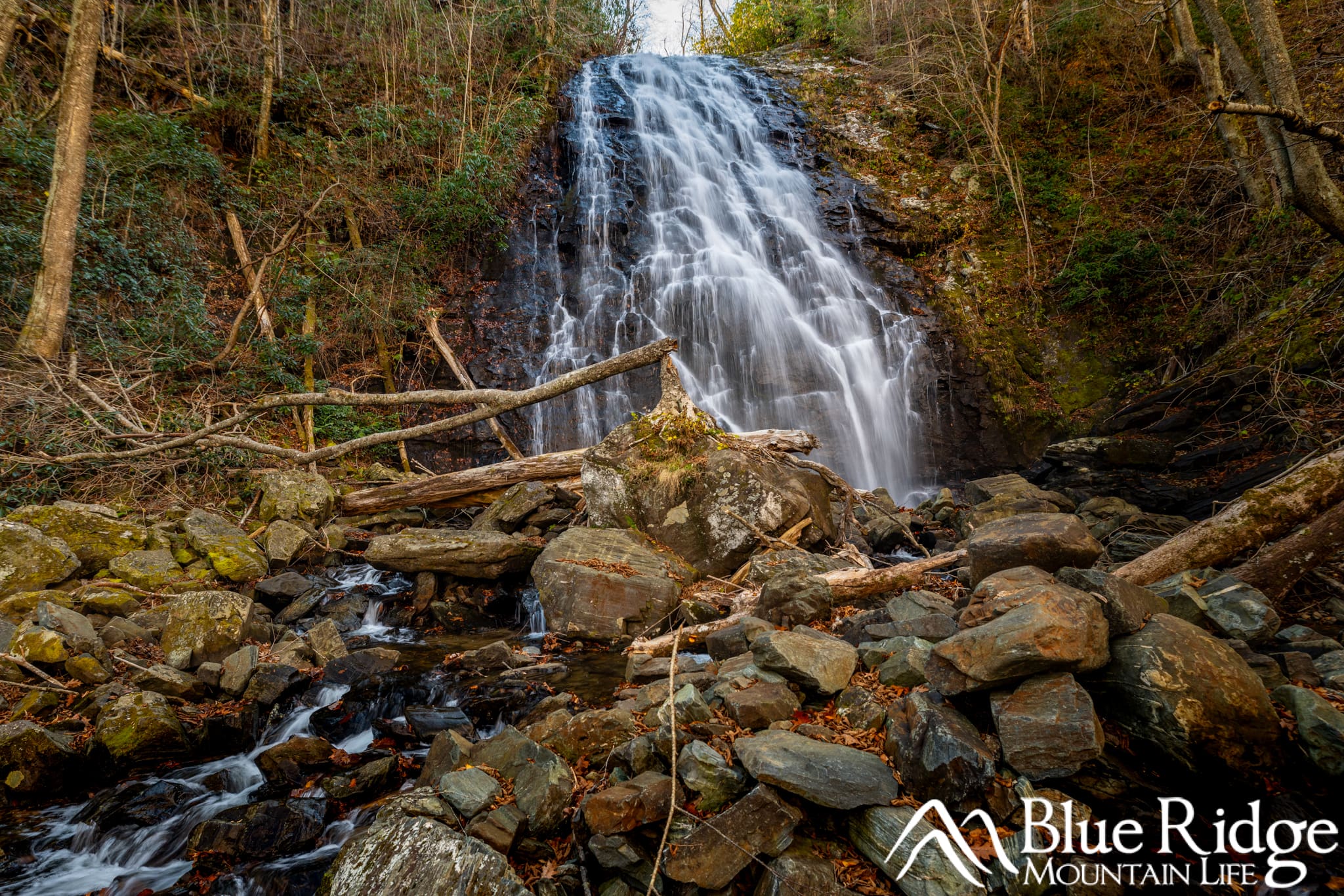
Crabtree Falls after Hurricane Helene
If you have visited before, you may remember the tree growing on top of the large rock at the base of the falls. That tree has fallen over. Seeing it down was another reminder of just how much this area went through.
There is still recovery work to do, but being able to hike back to Crabtree Falls is a huge milestone in Hurricane Helene recovery. We were so glad to see it reopen, and we are grateful to everyone who worked to make that possible.
Our Tips for Visiting Crabtree Falls
- Plan for the climb out. If stairs or uneven ground are difficult for you, consider whether this hike is a good fit. The waterfall is beautiful, but this is not a short, level walk from the car.
- Wear shoes with good traction. Rocks, stairs, and wet leaves can be slippery. Hiking poles may help with balance on the descent and climb.
- Allow extra time at the waterfall. This is a place we enjoy stopping to photograph, not just turning around as soon as we arrive.
- Photograph from the open trail and bridge. You can enjoy the falls without climbing on wet rocks or entering damaged creek areas. Leave room for other hikers to cross the bridge.
- Bring water, snacks, and leave enough daylight for the return. The uphill portion can take longer than the walk down.
Ready to explore more? See our Waterfalls Guide and Map for more of our firsthand waterfall guides.
Watch Our Crabtree Falls Hike Videos
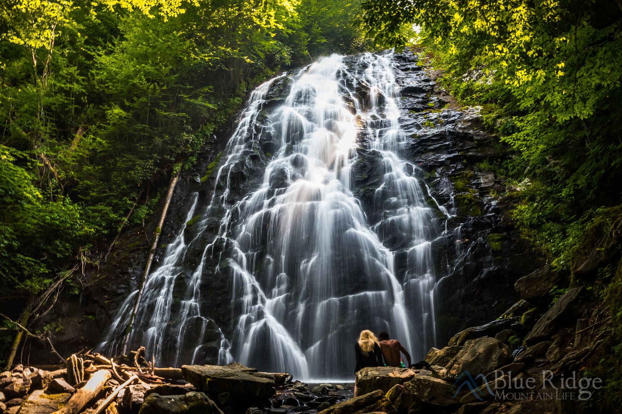
Come along with us on our return to Crabtree Falls after the trail reopened. We have also included our older summer hike below so you can see the falls before Hurricane Helene.
Here is our most recent video, just after the reopening on November 11, 2026:
Our earlier summer hike below was filmed before Hurricane Helene and shows the old bridge and loop trail. The loop is currently closed, so use the updated trail information above when planning your visit.
