If you're searching for a stunning waterfall hike in Pisgah National Forest, Cat Gap Loop Trail to Cedar Rock Falls should be high on your list.
Tucked away along the Cat Gap Loop Trail, this picturesque cascade offers a perfect blend of adventure and serenity, making it a must-see for both casual hikers and seasoned outdoor enthusiasts.
As locals living in Western NC, we've explored and documented many waterfalls across the region, and Cedar Rock Falls remains one of our favorites. Why? It’s the great hike for those who enjoy a nice wooded hike without the crowds—plus, its moderate difficulty level and minimal elevation changes make it a great option for families.
In this guide, we’ll share detailed directions, walk you through the hike, and everything you need to know to enjoy Cedar Rock Falls. Let’s dive in and discover why this waterfall deserves a spot on your Pisgah National Forest adventure list!
Updated: 2/6/2025 - Article was revised, new photos added, and info was added about Hurricane Helene damage.
Need to Know |
|---|
Location: Pisgah National Forest, Ranger District near Brevard NC |
Accessible: No |
Dog Friendly: Yes, but must be on a leash |
Distance: 1.8 miles round-trip |
Difficulty: Moderate |
Features: Two Waterfalls |
Directions: From The Blue Ridge Parkway, take Highway 276 towards Brevard. After passing Looking Glass Falls, watch for FR475 on the right, and turn right onto FR475 (very sharp turn). Watch for signs for the Pisgah Center for Wildlife Education, and turn left into the center. Park in front of the center. |
Hurricane Helene Damage
The trail to Cedar Rock Falls has some damage. The bridge that crosses Cedar Rock Creek is out, requiring a rock hop across the creek. We would definitely recommend wearing waterproof hiking boots or shoes for this.
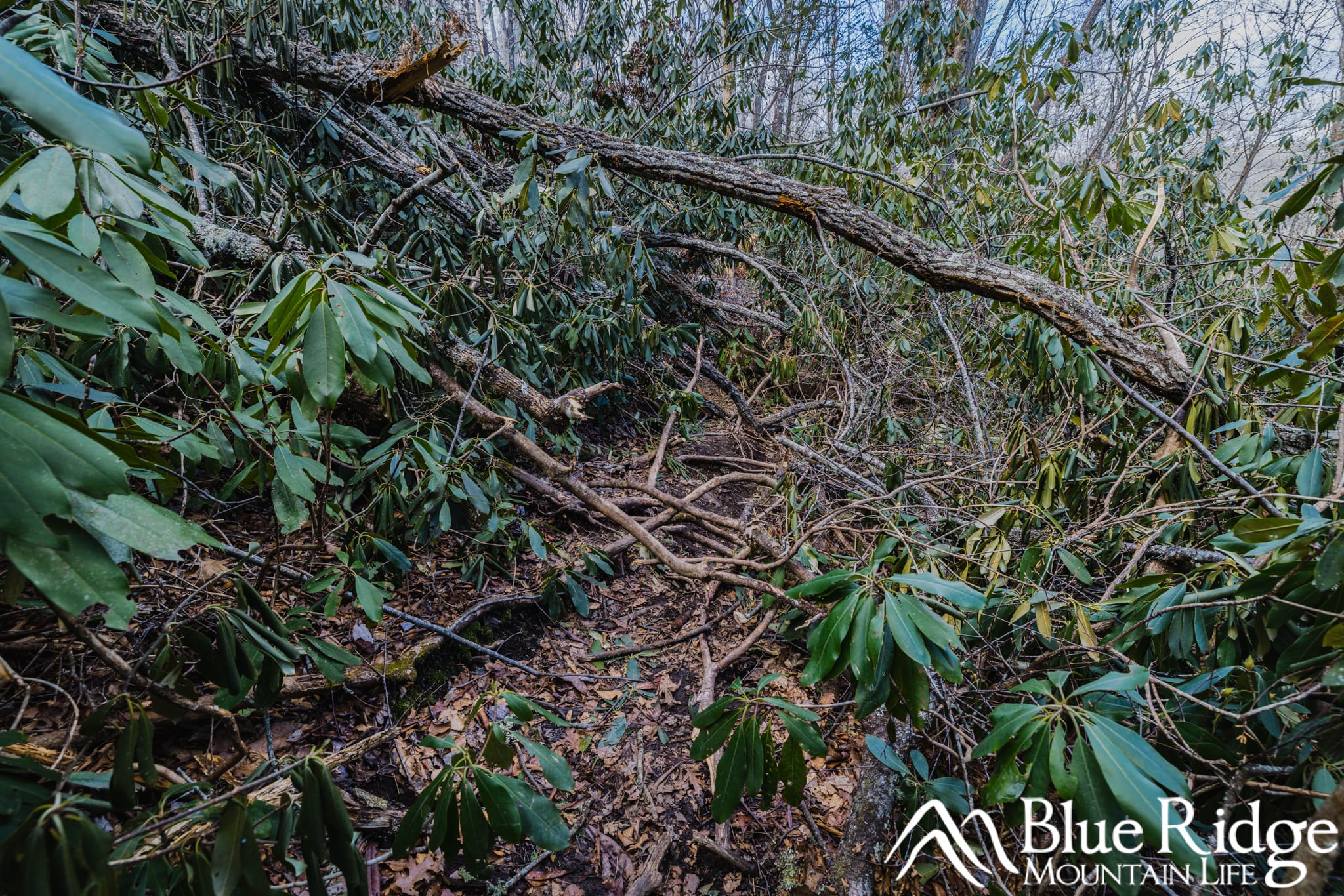
As you get close to the falls, the smaller trail that takes you down to it has considerable debris from some fallen trees. This will require you to climb over some trees and navigate around some branches.
Here is a photo to show what it looks like:
Where to Park
Cedar Rock Falls is one of three waterfalls that can be accessed via the Cat Gap Loop trail, which begins at the Pisgah Center for Wildlife Education and Fish Hatchery. The Fish Hatchery is currently closed, but the parking area across from the building is open and you should park there.
Cedar Rock Falls is the first of these three waterfalls and is a 1.8 mile round-trip hike.
Best time to visit
For those hiking out to just enjoy the falls, the best times will be anytime during the day. However, lighting is optimal from early morning to midafternoon.
For photographers, morning is going to be the best light on the waterfall. Afternoon/evening lighting is not good, as the sun drops behind the falls, making the falls way too dark.
Hiking to Cedar Rock Falls
From the parking lot, head to FR475C, which is on the back side of the Pisgah Center, and near the parking lot. The road is blocked with a gate, and hikers can access the road on either side of it. You'll immediately cross a bridge, and Cat Gap Loop Trail begins almost immediately on your right, and has a rectangle orange blaze.
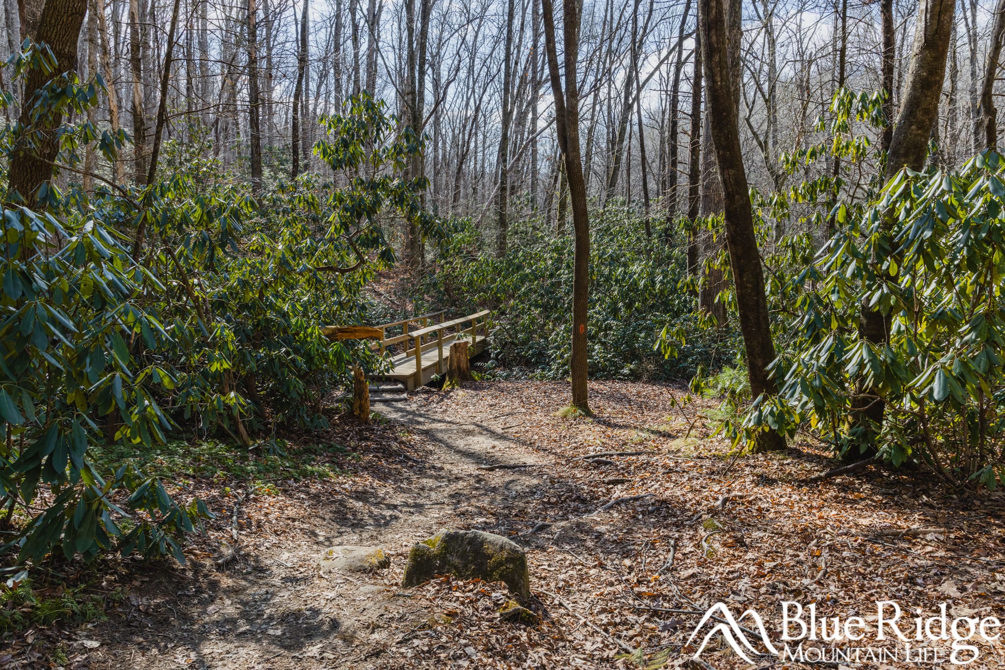
The initial part of the trail follows a long green fencing before the first creek crossing. There is a wide wood bridge here that will take you across the creek.
A little further down is another creek crossing. There was a bridge here, but flooding from Hurricane Helene in 2024 washed the bridge out. You'll have to rock hop across the creek.
After crossing, you'll cross a service road and begin climbing up through a beautiful rhododendron canopy. After another .5 mile, begin looking for a smaller trail that will veer off to the left and head down the ridge.
You'll most likely hear the falls at this point. If you are hiking in the winter, you can see it.
If you reach another small trail heading down to a primitive campsite on your left, you went too far. Although, this is the location for Upper Cedar Rock Falls.

Follow this unofficial and fairly steep trail down, where you'll reach a large rock cliff, soon followed by a view of the waterfall. You can climb down the rocks to reach the base of the falls.
Towards the rock cliff, there is considerable debris from trees that have fallen. You'll have to navigate your way over and around this. It's not too difficult, but something to be aware of.
Cedar Rock Falls

Spring at Cedar Rock Falls
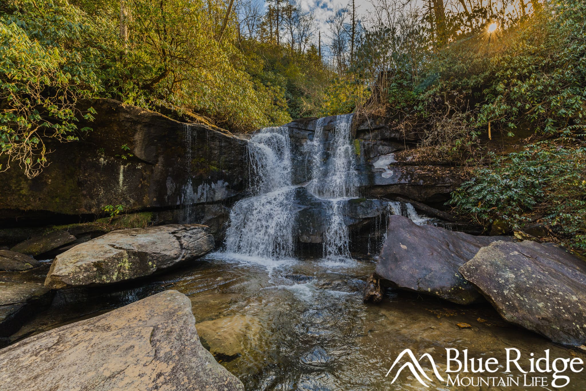
Again, Cedar Rock Falls is a small, but beautiful waterfall that is about 20' high. The creek splits above the falls, and results in two separate cascades down the nearly straight down rock cliffs. One cascade is significantly larger than the other. The falls are surrounded by rhododendron and Mountain Laurel.
If you decide to get up close to the falls, be very careful, as the moss and rocks can be very slick. There are many other smaller cascades both at the falls and below the falls that make for good photo spots. There are also a number of large rocks here, perfect for sitting on, and for taking photos.

Cedar Rock Falls is a surprisingly nice fall, that is also fairly popular. We often see people when visiting.
Upper Cedar Rock Falls

After visiting the falls, head back up the spur trail the way you came. This waterfall is actually one of three waterfalls along this trail. You can either return the way you came on the Cat Gap Loop trail to your car, OR continue further down the trail for the other two waterfalls.
Upper Cedar Rock Falls is just a short distance up the trail. The third waterfall, Grogan Creek Falls, is a littler further up, but well worth the extra hike!
Our Waterfall Guides
See our full guides to over 40 waterfalls in the Blue Ridge Mountains, on our Waterfalls Page. Information, Directions, Photos, Video, and more!


